Nationwide Landowner Info and Mapping
Try Acres+ with a free 7-day trial!


Land for Sale

Custom Maps

Share & Embed Maps

Property Lines

FSA Boundaries

Soils
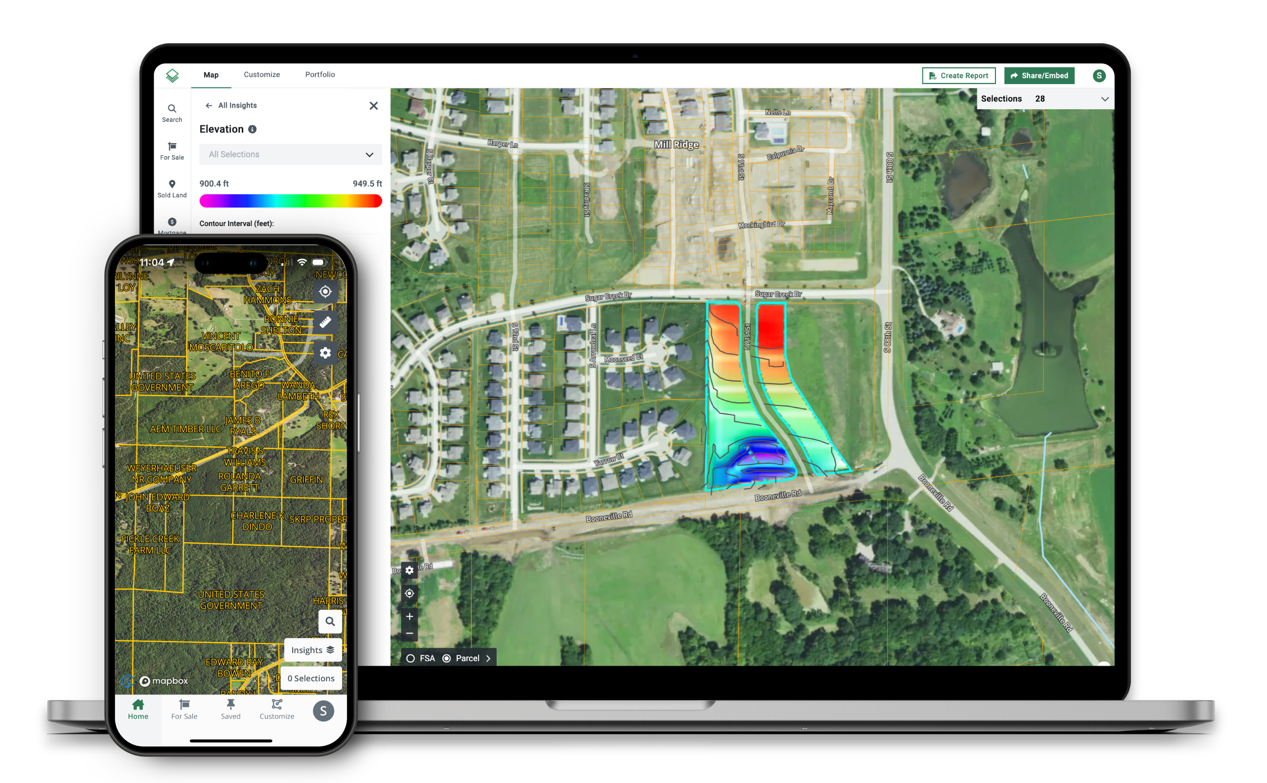
Elevation

Crop History

Vegetation Index (NDVI)
Historic Satellite Imagery

Flood & Wetlands

County Rent