

Plot Deeds in Seconds
Acres’ automated tool helps you plot legal descriptions for accurate boundary maps without the sweat.
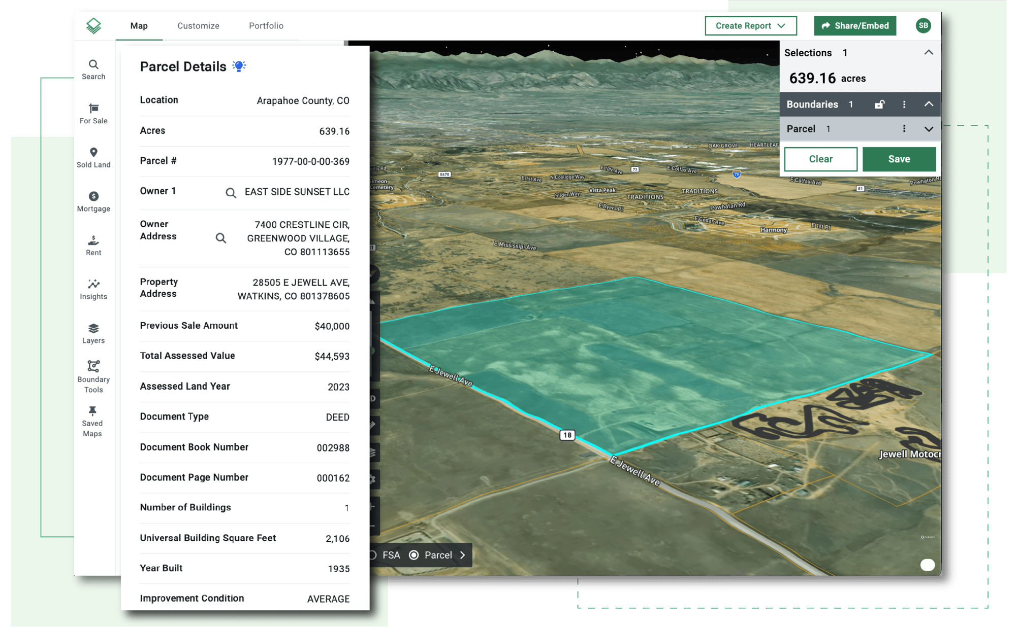
Up-to-Date Assessor Data in a Click
Speed up title research with the most up-to-date parcel-level assessor data available, including hard-to-access data from non-disclosure and partial disclosure states.

Easily Locate Target Properties
Save time finding specific parcels on Acres with advanced search tools. Filter by owner address, county, township-range, section, or parcel number—individually or in combination.
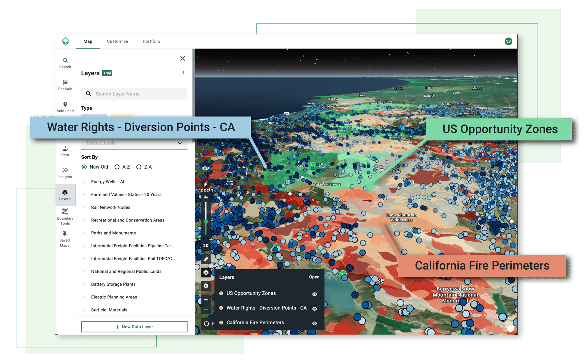
See Every Relevant Detail
Combine local data, like zoning, easements, and infrastructure maps, with Acres’ national and proprietary datasets to get a complete visual representation of a property.

Take Acres in the Field
Access property boundaries and features directly from the field. With the Acres mobile app, you can gather crucial insights while on-site, making your evaluation faster and more efficient.

